
University of Canterbury ponders how to apply drones to map burning forests to assist firefighters
Can drones be used to help in fire fighting operations? This is the question the University of Canterbury’s Spatial Engineering Research Centre (SERC) is investigating.
At the University of Canterbury, a research team is trying to figure out how to apply unmanned aerial vehicles (UAVs) on the edges of a forest that’s burning, identify hotspots, and map a picture of the fire for firefighters to act on.
A rural fire can continue to burn underground long after it has ceased burning on the surface. These underground hotspots can restart a fire and need to be extinguished by fire fighters. Existing methods for finding these hotspots involves either time intensive manual searching by teams of fire fighters or the use of a helicopter fitted with a thermal camera.
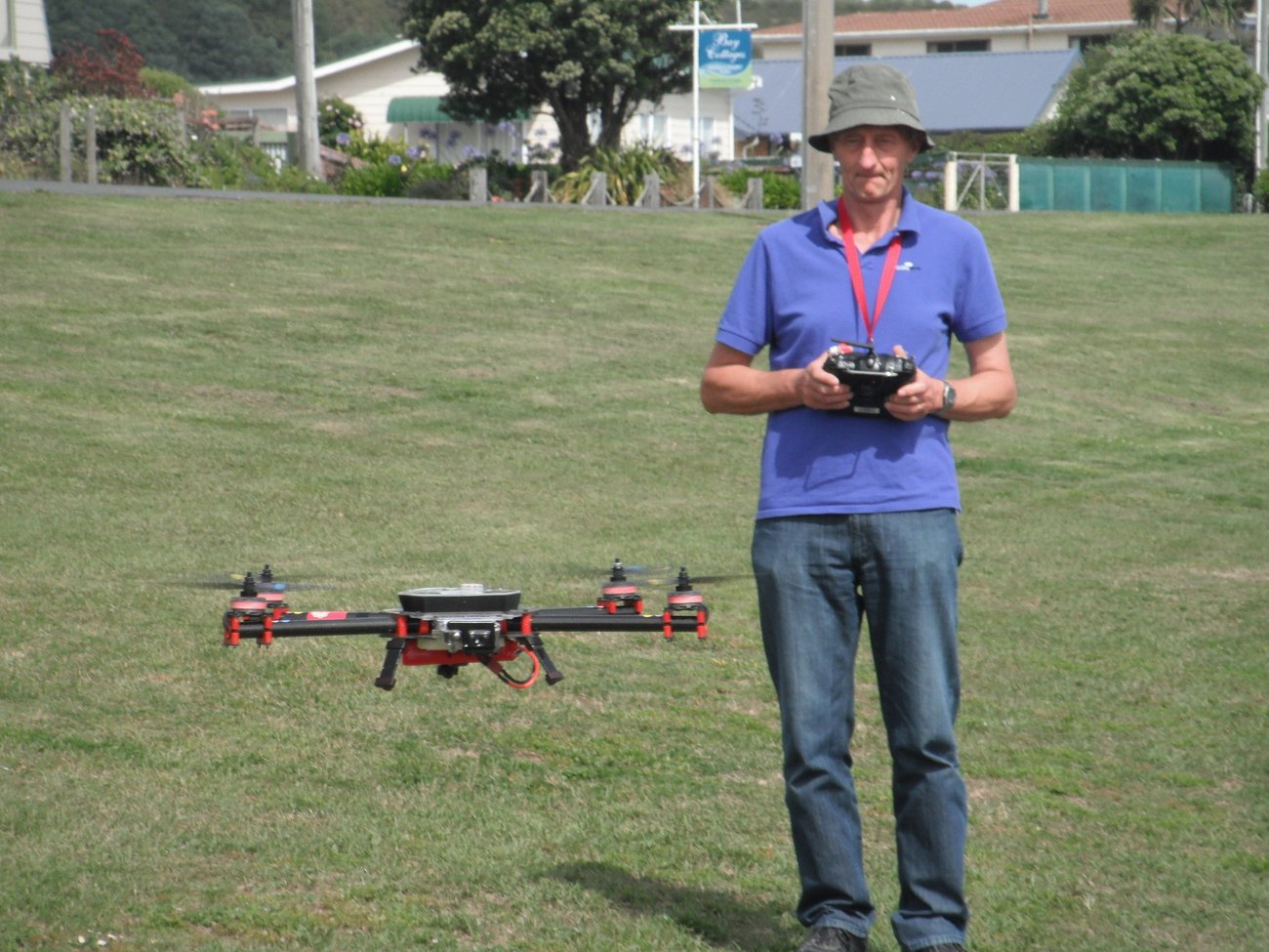
Final year electrical engineering student Ben Litchfield is working with his project supervisor, SERC’s senior research engineer, Kelvin Barnsdale on how to arm UAVs with special cameras for locating and mapping fire hot spots.
“My project aims to utilise UAVs armed with thermal cameras to quickly and cost effectively map the burned area and provide precise GPS coordinates of all hotspots,” Litchfield says.
“Spotting hotspots from helicopters can cost up to $5000 a day. The UAV used in the project is a quad copter and has a flight time of about 15 minutes.
“The quad copter is fitted with a gyroscopically stabilised high-end thermal camera and GPS equipment. A small on board computer stores each image captured by the thermal camera along with its matching GPS co-ordinate.
“Hot spots at the edges of burnt areas as these have the highest chance of re-igniting due to proximity to fuel. The long-term goal is for the small quadcopter to automatically detect and follow the edges of the burned area while noting the GPS co-ordinates of any hotspots it detects.
“This information would then be passed to fire crew as an accurate map of the hotspots in the area. We plan to visit any rural fire next month to test capabilities of the current prototype. Initial field testing has shown very positive results,” Litchfield says.
The investigation is sponsored by SCION, a Crown Research Institute.
At least 10 helicopters have had to be called in to fight a fire that has spread across 330 hectares of the Southern Alps which force the closure of State Highway 73.
Internationally, UAVs have excited scientists and industries who see drones being used for capturing data on how crop is growing, for monitoring wind speeds across vast areas, or search and rescue operations.
In New Zealand, Martin Aircraft is the doyen of the industry. The company is in the process of commercialising the First Responder Martin (FRM) which has an estimated price tag of around US$200,000 (not including the cost of customisation). Its Martin Skyhook, for instance, can be flown remotely, or (future development) through a pre-programme flight path. It can lift up to 105 kgs, giving it a variety of commercial or military applications.
The US Fire Department, for instance, has recently been allowed by the US government to operate drones in environmentally challenging environments and Martin Aircraft hopes to get a crack at this space.